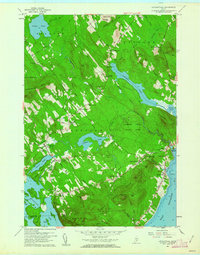
1960 Map of Lincolnville
USGS Topo · Published 1962About this map
Penobscot Bay meets the rising elevations of the Camden Hills State Park in this coastal Waldo County landscape. The 1960 survey illustrates a region defined by its diverse water bodies, from the expansive Megunticook Lake and its distinctive peninsulas like Fernalds Neck to smaller interior waters such as Norton Pond and Coleman Pond. Settlement patterns are concentrated at crossroads and coastal points, including the village of Lincolnville and the inland hub at Lincolnville Center. Historic institutional footprints are visible through the Lincolnville Sch and the Bayshore Union Ch near the shore. The terrain is marked by prominent peaks like Megunticook Mtn and Bald Rock Mtn, while the local economy is evidenced by numerous Sand and Gravel Pits and the winding course of the Ducktrap River.
Find a feature on this map
76 named features on this map. Tap any name to fly to it.
Don’t see what you’re looking for? This feature index may not catch every label — zoom into the map to look around manually.
Map Details
Editions of this 1960 Lincolnville Map
3 editions found
Other maps of this area

1902 · Castine
USGS Topo · 1:62,500

1904 · Castine
USGS Topo · 1:62,500

1904 · Vinalhaven
USGS Topo · 1:62,500

1904 · Rockland
USGS Topo · 1:62,500

1905 · Penobscot Bay
USGS Topo · 1:125,000

1906 · Rockland
USGS Topo · 1:62,500

1915 · Belfast
USGS Topo · 1:62,500

1917 · Belfast
USGS Topo · 1:62,500

1941 · Belfast
USGS Topo · 1:62,500

1941 · Rockland
USGS Topo · 1:62,500