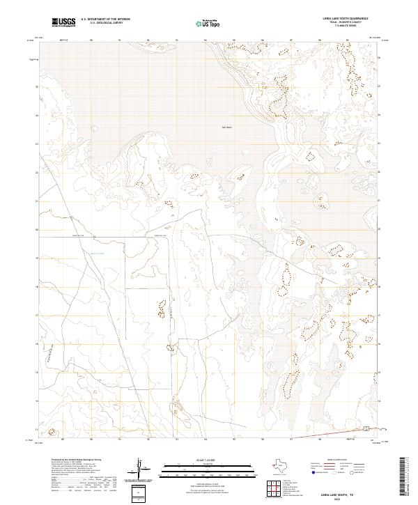
2022 Map of Linda Lake South
USGS Topo · Published 2022About this map
Salt Basin dominates the northeastern reaches of this West Texas landscape, where the flat, arid floor of the Trans-Pecos meets the subtle contours of the Chihuahuan Desert. The environment is defined by its water management and drainage patterns, anchored by Russel Tank and the long, winding path of Eightmile Draw. These features represent the critical infrastructure of a ranching-focused economy, where natural and man-made catchments dictate the utility of the land. Human presence is concentrated along the corridor of Ranch Rd 1576, which serves as the primary artery through this sparsely populated section of Hudspeth County. The map captures a topography where the sparse distribution of named points highlights the significance of every well and drainage path in an otherwise open desert expanse.
Find a feature on this map
4 named features on this map. Tap any name to fly to it.
Don’t see what you’re looking for? This feature index may not catch every label — zoom into the map to look around manually.
Map Details
Editions of this 2022 Linda Lake South Map
This is the sole edition of this map. No revisions or reprints were ever made.
Other maps of this area

1933 · Guadalupe Peak
USGS Topo · 1:48,000

1940 · Guadalupe Peak
USGS Topo · 1:62,500

1951 · Dell City
USGS Topo · 1:62,500

1954 · Van Horn
USGS Topo · 1:250,000

1955 · Black Mountains
USGS Topo · 1:62,500

1958 · Van Horn
USGS Topo · 1:250,000

1973 · Bitter Well Mountain NW
USGS Topo · 1:24,000
1973 · Patterson Hills
USGS Topo · 1:24,000
1973 · P X Flat
USGS Topo · 1:24,000
1984 · Dell City
USGS Topo · 1:24,000