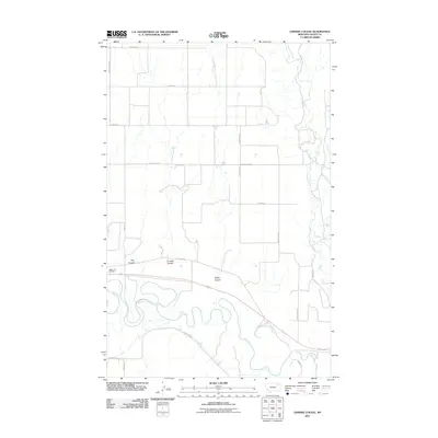
2011 Map of Lindeke Coulee
USGS Topo · Published 2011About this map
The Milk River meanders through the southern half of this landscape, its tight oxbows and river bends carving out a distinct valley floor below the high plains. This 2011 survey captures the area's rural road network, defined by family and local identifiers such as Whately Rd and Lindell Rd. The map is characterized by its named drainage features, including Lindeke Coulee and Espeil Coulee, which cut through the terrain toward the river basin. Cultural landmarks are sparse in this portion of Valley County, with Memorial Gardens serving as a significant point of interest near the regional thoroughfares. To the north, the terrain transitions into more systematic road grids, such as those along E Hanson Rd, while Porcupine Creek defines the northeastern boundary. The alignment of Roosevelt Trl suggests its role as a primary artery across this eastern Montana reach.
Find a feature on this map
19 named features on this map. Tap any name to fly to it.
Don’t see what you’re looking for? This feature index may not catch every label — zoom into the map to look around manually.
Map Details
Editions of this 2011 Lindeke Coulee Map
This is the sole edition of this map. No revisions or reprints were ever made.
Other maps of this area

1914 · Nashua
USGS Topo · 1:62,500

1916 · Nashua
USGS Topo · 1:62,500

1918 · Porcupine Valley
USGS Topo · 1:62,500

1943 · Glasgow
USGS Topo · 1:125,000

1954 · Glasgow
USGS Topo · 1:250,000

1957 · Glasgow
USGS Topo · 1:250,000

1958 · Glasgow
USGS Topo · 1:250,000

1958 · Wheeler
USGS Topo · 1:24,000

1958 · Whately
USGS Topo · 1:24,000

1969 · Hawk Coulee
USGS Topo · 1:24,000