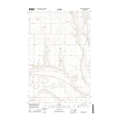
2014 Map of Lindeke Coulee
USGS Topo · Published 2014About this map
The Milk River meanders across the southern portion of this landscape, its wide valley floor and intricate oxbows contrasting with the dissected uplands to the north. These northern reaches are defined by a series of significant drainages, including the namesake Lindeke Coulee, Espeil Coulee, and Hay Coulee, which carve through the plains. The transport network reflects both historical and modern passage through Valley County, centered on the prominent corridor of Us-2 and the Roosevelt Trl. Local movement is facilitated by a grid of rural routes such as Fox Farm Rd and Old Smokey Rd, while Memorial Gardens stands as a quiet landmark near the highway. The map illustrates a ranching and agricultural landscape shaped by the persistent flow of water and the necessity of reliable roads across the Montana prairie.
Find a feature on this map
28 named features on this map. Tap any name to fly to it.
Don’t see what you’re looking for? This feature index may not catch every label — zoom into the map to look around manually.
Map Details
Editions of this 2014 Lindeke Coulee Map
This is the sole edition of this map. No revisions or reprints were ever made.
Other maps of this area

1914 · Nashua
USGS Topo · 1:62,500

1916 · Nashua
USGS Topo · 1:62,500

1918 · Porcupine Valley
USGS Topo · 1:62,500

1943 · Glasgow
USGS Topo · 1:125,000

1954 · Glasgow
USGS Topo · 1:250,000

1957 · Glasgow
USGS Topo · 1:250,000

1958 · Glasgow
USGS Topo · 1:250,000

1958 · Wheeler
USGS Topo · 1:24,000

1958 · Whately
USGS Topo · 1:24,000

1969 · Hawk Coulee
USGS Topo · 1:24,000