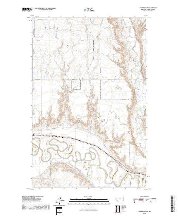
2024 Map of Lindeke Coulee
USGS Topo · Published 2024About this map
The meandering Milk River dominates the southern landscape of this Valley County region, carving a wide alluvial valley defined by its oxbow curves and floodplains. Just north of the river, the Memorial Gardens cemetery serves as a notable local landmark near the junction of Fox Farm Rd. The terrain is characterized by a series of north-south drainage features, most notably Lindeke Coulee, which cuts through the central sections, alongside the smaller Espert Coulee and Hay Coulee. To the east, Porcupine Creek winds through the breaks before reaching the river valley. The upland areas are gridded by a network of rural routes including Roosevelt Trl, Pump House Rd, and Old Smokey Rd, reflecting the sparse but organized land use typical of Montana’s high plains.
Find a feature on this map
24 named features on this map. Tap any name to fly to it.
Don’t see what you’re looking for? This feature index may not catch every label — zoom into the map to look around manually.
Map Details
Editions of this 2024 Lindeke Coulee Map
This is the sole edition of this map. No revisions or reprints were ever made.
Other maps of this area

1914 · Nashua
USGS Topo · 1:62,500

1916 · Nashua
USGS Topo · 1:62,500

1918 · Porcupine Valley
USGS Topo · 1:62,500

1943 · Glasgow
USGS Topo · 1:125,000

1954 · Glasgow
USGS Topo · 1:250,000

1957 · Glasgow
USGS Topo · 1:250,000

1958 · Glasgow
USGS Topo · 1:250,000

1958 · Wheeler
USGS Topo · 1:24,000

1958 · Whately
USGS Topo · 1:24,000

1969 · Hawk Coulee
USGS Topo · 1:24,000