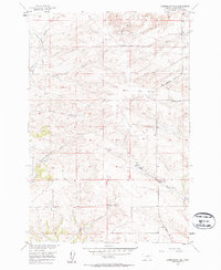
1956 Map of Lindemulder Hill
USGS Topo · Published 1958About this map
Lindemulder Hill and Busteed Hill dominate the topography of this Stillwater County landscape, which is bisected by the prominent ridge known as The Divide. In the mid-1950s, this area of Montana remained primarily defined by its drainage systems and small rural landmarks. Educational life centered on the Mountain View Sch and Keyser Creek Sch, which served the scattered residents of the upland coulees and creek bottoms. The presence of a Pipeline cutting across the northern sections indicates the growing industrial infrastructure of the era, contrasting with the traditional ranching landscape marked by numerous waterways like McNabb Creek, Cow Creek, and Cottonwood Creek. The intricate contour lines reveal the complex erosion patterns that have shaped this high-plains terrain south of the Musselshell-Yellowstone watershed divide.
Find a feature on this map
17 named features on this map. Tap any name to fly to it.
Don’t see what you’re looking for? This feature index may not catch every label — zoom into the map to look around manually.
Map Details
Editions of this 1956 Lindemulder Hill Map
2 editions found
Other maps of this area

1892 · Stillwater
USGS Topo · 1:125,000

1954 · Billings
USGS Topo · 1:250,000

1955 · Antelope Point
USGS Topo · 1:24,000

1955 · Springtime
USGS Topo · 1:24,000

1955 · Russell Gulch
USGS Topo · 1:24,000

1956 · Columbus West
USGS Topo · 1:24,000

1956 · Rapelje
USGS Topo · 1:24,000

1956 · Battle Butte
USGS Topo · 1:24,000

1956 · Columbus East
USGS Topo · 1:24,000

1956 · Lindemulder Hill
USGS Topo · 1:24,000