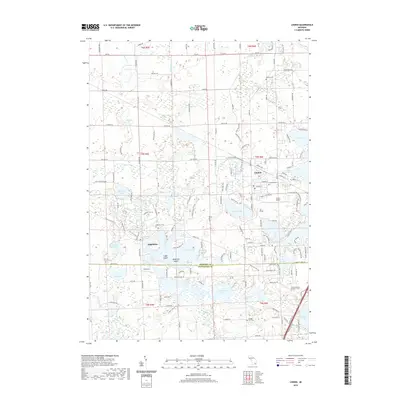
2019 Map of Linden
USGS Topo · Published 2019About this map
The Shiawassee River winds through the heart of Linden and Argentine, creating a complex network of waterways and wetlands that define the local landscape. This modern survey illustrates the proximity of residential expansion to older rural landmarks, such as Kimball Cem and the Argentine Cem. The terrain is characterized by a high density of named water bodies, including Byram Lake, Lobdell Lake, and Pine Lake, which historically shaped the development of these lakefront communities. Institutional and industrial footprints are visible through Linden Middle School and the aviation grounds of Prices Airport east of the village center. A clear administrative division is marked by the Genesee Co Livingston Co line, which bisects larger lakes and marshlands, illustrating how political boundaries overlay the natural drainage systems of Porter Drain and Kimball Drain.
Find a feature on this map
169 named features on this map. Tap any name to fly to it.
Don’t see what you’re looking for? This feature index may not catch every label — zoom into the map to look around manually.
Map Details
Editions of this 2019 Linden Map
This is the sole edition of this map. No revisions or reprints were ever made.
Other maps of this area

1907 · Howell
USGS Topo · 1:62,500

1909 · Howell
USGS Topo · 1:62,500

1909 · Milford
USGS Topo · 1:62,500

1920 · Holly
USGS Topo · 1:62,500

1922 · Holly
USGS Topo · 1:62,500

1922 · Durand
USGS Topo · 1:62,500

1943 · Holly
USGS Topo · 1:62,500

1943 · Durand
USGS Topo · 1:62,500

1954 · Detroit
USGS Topo · 1:250,000

1961 · Detroit
USGS Topo · 1:250,000