2023 Map of Linden
USGS Topo · Published 2023About this map
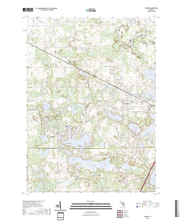
The Shiawassee River winds through the village of Linden and the settlement of Argentine, connecting a complex system of glacial kettle lakes and wetlands in southern Michigan. The landscape is defined by its abundance of water, including the expansive Lobdell Lake, Byram Lake, and Murray Lake, which are separated by low-lying peninsulas like Blue Gill Island. This contemporary topography reflects a deeply established community, evidenced by several local burial grounds such as Fairview Cem and the Argentine Cem. Education and regional aviation are anchored by the Linden Middle School and Prices Airport, while the grid of roads like Silver Lake Rd and Lahring Rd provides a look at the modern suburban and rural residential patterns that have emerged around the historical lakefronts. The map also records the boundary line between Genesee and Livingston counties, marking a transition between the northern and southern reaches of the local townships.
Find a feature on this map
67 named features on this map. Tap any name to fly to it.
Don’t see what you’re looking for? This feature index may not catch every label — zoom into the map to look around manually.
Map Details
Editions of this 2023 Linden Map
This is the sole edition of this map. No revisions or reprints were ever made.