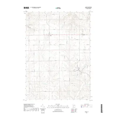
2018 Map of Linden
USGS Topo · Published 2018About this map
Linden and the surrounding Iowa County uplands appear in this 2018 survey, centered on the historic mining and agricultural corridor of southwestern Wisconsin. The landscape is defined by the headwaters of several key drainage systems, with the Pecatonica River winding through the southern reaches and the Blue River originating to the northwest. The village of Cobb sits along the northern ridge near Edmund, serving as local hubs for the rural road network that includes Co Rd G and Division St. The map illustrates a typical Driftless Area topography of narrow ridges and branching valleys, such as Foreman Hollow and the drainage of Cave Hollow Cr. Local history is anchored by landmarks like the Thomas Cem and the small-town street grids of these established communities, providing a contemporary view of a region with deep lead-mining and farming roots.
Find a feature on this map
65 named features on this map. Tap any name to fly to it.
Don’t see what you’re looking for? This feature index may not catch every label — zoom into the map to look around manually.
Map Details
Editions of this 2018 Linden Map
This is the sole edition of this map. No revisions or reprints were ever made.
Other maps of this area

1902 · Mineral Point
USGS Topo · 1:125,000

1905 · Richland Center
USGS Topo · 1:125,000

1952 · Rewey
USGS Topo · 1:24,000

1952 · Montfort
USGS Topo · 1:24,000

1952 · Mineral Point
USGS Topo · 1:24,000

1952 · Dodgeville
USGS Topo · 1:24,000

1952 · Linden
USGS Topo · 1:24,000

1952 · Mifflin
USGS Topo · 1:24,000

1958 · La Crosse
USGS Topo · 1:250,000

1959 · Dubuque
USGS Topo · 1:250,000