2022 Map of Linden
USGS Topo · Published 2022About this map
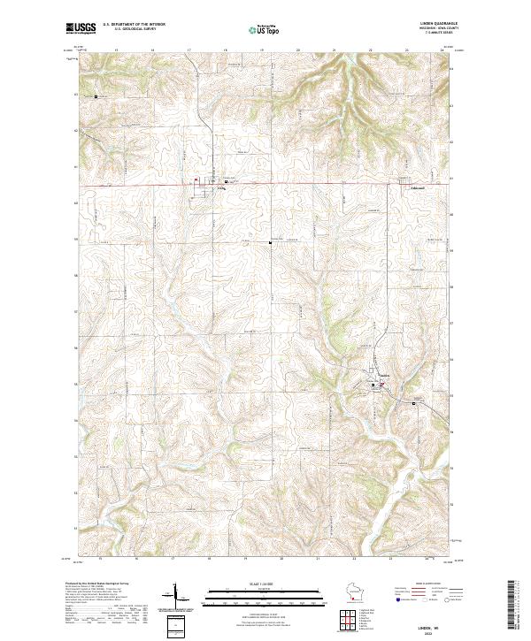
The Pecatonica River winds through the southern half of this landscape, while the village of Linden sits at a crossroads to the east. This section of Wisconsin’s Driftless Area is defined by a dense network of coulees and ridges, with Foreman Hollow and Cave Hollow Cr shaping the northern terrain. For those tracing local history, the map preserves the locations of several burial grounds, including the Linden Cem and the Peddlers Creek Cem, which speak to the early settlement patterns of the region.
Find a feature on this map
74 named features on this map. Tap any name to fly to it.
Don’t see what you’re looking for? This feature index may not catch every label — zoom into the map to look around manually.
Map Details
Editions of this 2022 Linden Map
This is the sole edition of this map. No revisions or reprints were ever made.