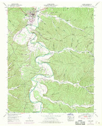
1950 Map of Linden
USGS Topo · Published 1970About this map
The Buffalo River carves a serpentine path through this Tennessee landscape, defining the rural character of Linden and its outlying communities. Settlement patterns are closely tied to the river's fertile bottomlands, with Beech Bottom and Ledbetter Island marking significant breaks in the timbered terrain. The presence of several fords, including Washplace Ford and Cow Ford, highlights the historical reliance on river crossings prior to modern bridge infrastructure.
Find a feature on this map
70 named features on this map. Tap any name to fly to it.
Don’t see what you’re looking for? This feature index may not catch every label — zoom into the map to look around manually.
Map Details
Editions of this 1950 Linden Map
3 editions found
Other maps of this area

1905 · Waynesboro
USGS Topo · 1:125,000

1936 · Graves Spring
USGS Topo · 1:24,000

1936 · Pleasantville
USGS Topo · 1:24,000

1936 · Pine View
USGS Topo · 1:24,000

1936 · Linden
USGS Topo · 1:24,000

1936 · Leatherwood
USGS Topo · 1:24,000

1936 · Clifton
USGS Topo · 1:24,000

1936 · Chestnut Grove
USGS Topo · 1:24,000

1936 · Topsy
USGS Topo · 1:24,000

1936 · Pope
USGS Topo · 1:24,000