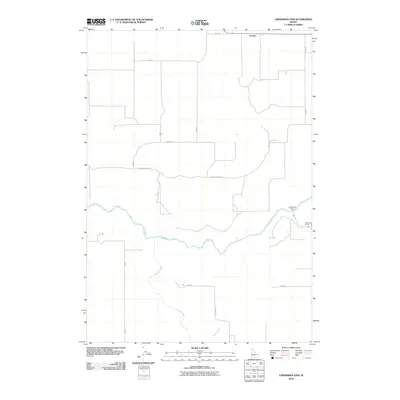
2010 Map of Linderman Dam
USGS Topo · Published 2010About this map
The Teton River carves a deep path through this landscape, defining the character of the region. Near the eastern edge, Linderman Dam and the nearby Linderman Ranch represent the intersection of local water management and traditional agriculture. The rural settlement of Farnum sits at the northern edge, connected to the river valley by a grid of county roads such as Old Hog Hollow Rd. These routes trace the high ground between the main river and its southern tributaries, including Canyon Creek and Crooked Creek. The topography here reveals a series of drainage patterns and ranching infrastructure typical of the high plains, providing a detailed look at how the water systems were navigated and utilized in the early 21st century.
Find a feature on this map
18 named features on this map. Tap any name to fly to it.
Don’t see what you’re looking for? This feature index may not catch every label — zoom into the map to look around manually.
Map Details
Editions of this 2010 Linderman Dam Map
This is the sole edition of this map. No revisions or reprints were ever made.
Other maps of this area

1949 · Newdale
USGS Topo · 1:24,000

1950 · Newdale
USGS Topo · 1:24,000

1951 · White Owl Butte
USGS Topo · 1:24,000

1955 · Ashton
USGS Topo · 1:250,000

1955 · Driggs
USGS Topo · 1:250,000

1958 · Driggs
USGS Topo · 1:250,000

1958 · Ashton
USGS Topo · 1:250,000

1960 · Ashton
USGS Topo · 1:250,000

1962 · Driggs
USGS Topo · 1:250,000

1965 · Lemon Lake
USGS Topo · 1:24,000