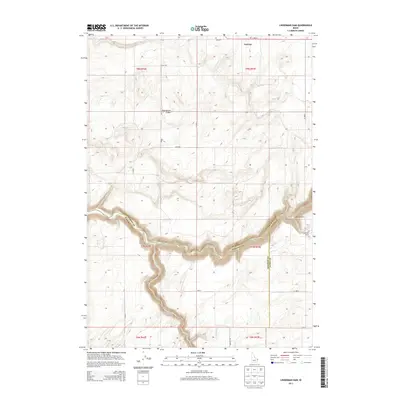
2013 Map of Linderman Dam
USGS Topo · Published 2013About this map
Teton River carves a deep, sinuous path across this landscape, defining the administrative boundaries where Madison, Fremont, and Teton counties converge. The river's winding course is the central focus, punctuated by the namesake Linderman Dam and the nearby Linderman Ranch in the eastern portion of the survey. North of the river canyon, the topography shifts to a high plateau marked by volcanic geography, most notably the Hog Hollow Crater.
Find a feature on this map
22 named features on this map. Tap any name to fly to it.
Don’t see what you’re looking for? This feature index may not catch every label — zoom into the map to look around manually.
Map Details
Editions of this 2013 Linderman Dam Map
This is the sole edition of this map. No revisions or reprints were ever made.
Other maps of this area

1949 · Newdale
USGS Topo · 1:24,000

1950 · Newdale
USGS Topo · 1:24,000

1951 · White Owl Butte
USGS Topo · 1:24,000

1955 · Ashton
USGS Topo · 1:250,000

1955 · Driggs
USGS Topo · 1:250,000

1958 · Driggs
USGS Topo · 1:250,000

1958 · Ashton
USGS Topo · 1:250,000

1960 · Ashton
USGS Topo · 1:250,000

1962 · Driggs
USGS Topo · 1:250,000

1965 · Lemon Lake
USGS Topo · 1:24,000