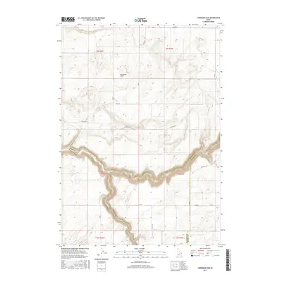
2017 Map of Linderman Dam
USGS Topo · Published 2017About this map
The Teton River carves a deep, winding canyon through the high plateau of eastern Idaho, serving as a natural divider where Madison, Fremont, and Teton counties meet. This rugged stretch of the river is punctuated by the Linderman Dam, an important water control point in this agricultural region. The surrounding landscape is defined by its volcanic geology, most notably the Hog Hollow Crater to the north, which stands as a prominent topographical feature above the surrounding plains. Human activity is largely traced by a grid of rural roads and the undulating path of Hog Hollow Rd, reflecting the intersection of natural riverine geography and the managed land of the Public Land Survey System sections. The canyon of Crooked Cr enters from the south, adding to the complex drainage network that feeds into the main river valley.
Find a feature on this map
14 named features on this map. Tap any name to fly to it.
Don’t see what you’re looking for? This feature index may not catch every label — zoom into the map to look around manually.
Map Details
Editions of this 2017 Linderman Dam Map
This is the sole edition of this map. No revisions or reprints were ever made.
Other maps of this area

1949 · Newdale
USGS Topo · 1:24,000

1950 · Newdale
USGS Topo · 1:24,000

1951 · White Owl Butte
USGS Topo · 1:24,000

1955 · Ashton
USGS Topo · 1:250,000

1955 · Driggs
USGS Topo · 1:250,000

1958 · Driggs
USGS Topo · 1:250,000

1958 · Ashton
USGS Topo · 1:250,000

1960 · Ashton
USGS Topo · 1:250,000

1962 · Driggs
USGS Topo · 1:250,000

1965 · Lemon Lake
USGS Topo · 1:24,000