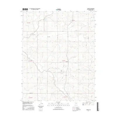
2017 Map of Lindrith
USGS Topo · Published 2017About this map
Lindrith serves as the central hub of this Rio Arriba County landscape, where the high desert terrain is deeply incised by a network of seasonal drainages and canyons. The settlement pattern is defined by the proximity to these watercourses, with Schmitz Ranch and the locality of Ojito situated amidst the rugged breaks of Gavilan Canyon and Oso Canyon. Transport and logistics are anchored by the Lindrith Airpark, reflecting the region's reliance on aerial access alongside a grid of county roads such as Co RD 402 and Co RD 395. The presence of small water bodies like Gavilan Lake, Monte Lake, and Bear Lake provide critical reference points in an otherwise arid environment characterized by the large canyon systems of Cañada Jacquez and Medio Canyon. This survey captures the rural character of northern New Mexico, illustrating how modern aviation infrastructure integrates with traditional ranching outposts and land divisions.
Find a feature on this map
36 named features on this map. Tap any name to fly to it.
Don’t see what you’re looking for? This feature index may not catch every label — zoom into the map to look around manually.
Map Details
Editions of this 2017 Lindrith Map
This is the sole edition of this map. No revisions or reprints were ever made.
Other maps of this area

1889 · Largo
USGS Topo · 1:250,000

1895 · Largo
USGS Topo · 1:250,000

1909 · Gallina
USGS Topo · 1:125,000

1940 · Cuba
USGS Topo · 1:62,500

1943 · Cuba
USGS Topo · 1:62,500

1954 · Aztec
USGS Topo · 1:250,000

1955 · Llaves
USGS Topo · 1:62,500

1958 · Aztec
USGS Topo · 1:250,000

1962 · Aztec
USGS Topo · 1:250,000

1963 · Schmitz Ranch
USGS Topo · 1:24,000