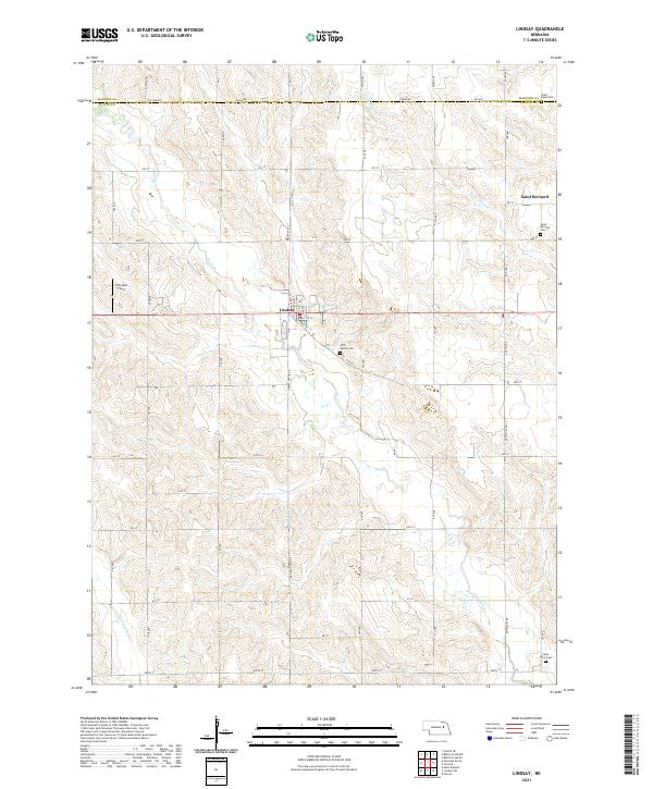
2021 Map of Lindsay
USGS Topo · Published 2021About this map
Lindsay serves as the primary hub of this agricultural landscape in northern Platte Co, situated where Lindsay-Genoa RD intersects with local avenues and streets. The settlement pattern is defined by a dense grid of rural roads, including Co Line RD at the boundary with Madison Co, which facilitate access to the vast farmsteads of the region. Local heritage is deeply rooted in several historical parish sites, such as the village of Saint Bernard and several associated burying grounds including Saint Bernard Cem and Saint Pauls Cem near the northern border.
Find a feature on this map
46 named features on this map. Tap any name to fly to it.
Don’t see what you’re looking for? This feature index may not catch every label — zoom into the map to look around manually.
Map Details
Editions of this 2021 Lindsay Map
This is the sole edition of this map. No revisions or reprints were ever made.
Other maps of this area

1955 · Fremont
USGS Topo · 1:250,000

1957 · Fremont
USGS Topo · 1:250,000

1958 · Fremont
USGS Topo · 1:250,000

1958 · St. Edward
USGS Topo · 1:24,000

1963 · Closter SE
USGS Topo · 1:24,000

1963 · Battle Creek SE
USGS Topo · 1:24,000

1963 · Battle Creek SW
USGS Topo · 1:24,000
1966 · Newman Grove
USGS Topo · 1:24,000

1966 · Tarnov
USGS Topo · 1:24,000
1966 · Lindsay SW
USGS Topo · 1:24,000