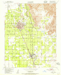
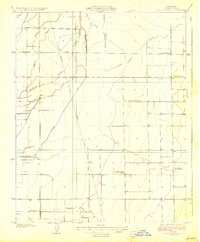
1951 Map of Lindsay
USGS Topo · Published 1956About this map
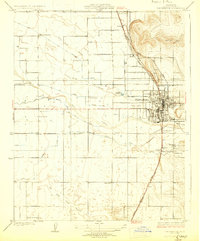
Lindsay and the surrounding Tulare County groves appear here in the early 1950s, defined by a rigid grid of agricultural avenues and three major rail lines. The Southern Pacific RR, Atchison Topeka and Santa Fe Ry, and Visalia Electric RR converge in the town center, supporting the region's citrus industry. To the east, the landscape transitions from the flat valley floor to the prominent heights of Elephant Back and Lindsay Peak. The engineering of the Friant-Kern Canal is clearly visible as it skirts the foothills, providing the essential water for the valley's development. Smaller settlements such as Strathmore, Tonyville, and El Mirador are mapped alongside local landmarks like the Trauger Airport and the Strathmore Indian Reservation, reflecting the complex social and industrial geography of the mid-century Central Valley.
Find a feature on this map
61 named features on this map. Tap any name to fly to it.
Don’t see what you’re looking for? This feature index may not catch every label — zoom into the map to look around manually.
Map Details
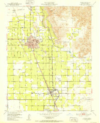
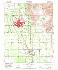
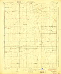
Editions of this 1951 Lindsay Map
3 editions found
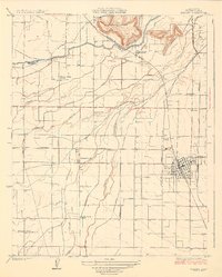
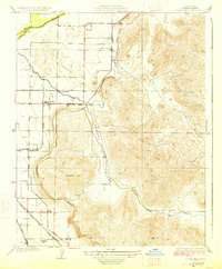
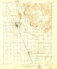
Other maps of this area

1904 · Kaweah
USGS Topo · 1:125,000

1909 · Kaweah
USGS Topo · 1:125,000

1925 · Rocky Hill
USGS Topo · 1:31,680
1926 · Exeter
USGS Topo · 1:31,680
1927 · Cairns Corner
USGS Topo · 1:31,680
1927 · Rocky Hill
USGS Topo · 1:31,680
1928 · Woodville
USGS Topo · 1:31,680
1928 · Lindsay
USGS Topo · 1:31,680
1929 · Porterville
USGS Topo · 1:31,680

1937 · Kaweah
USGS Topo · 1:125,000