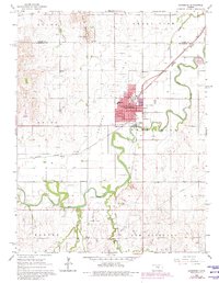
1965 Map of Lindsborg
USGS Topo · Published 1980About this map
The town of Lindsborg serves as the cultural and educational hub of this region, anchored by the campus of Bethany College and the surrounding urban grid. The settlement pattern is deeply influenced by the winding course of the Smoky Hill River, which creates a lush riparian corridor through the agricultural plains. Significant local industry and resource extraction are evident to the south and east, marked by the Lindsborg South Oil Field and several extraction sites including a Claypit and various Sandpits.
Find a feature on this map
44 named features on this map. Tap any name to fly to it.
Don’t see what you’re looking for? This feature index may not catch every label — zoom into the map to look around manually.
Map Details
Editions of this 1965 Lindsborg Map
3 editions found
Other maps of this area

1891 · Hutchinson
USGS Topo · 1:125,000

1892 · Salina
USGS Topo · 1:125,000

1893 · Hutchinson
USGS Topo · 1:125,000

1942 · Salina
USGS Topo · 1:125,000

1955 · Assaria
USGS Topo · 1:24,000

1955 · Smolan
USGS Topo · 1:24,000

1955 · Falun
USGS Topo · 1:24,000

1955 · Hutchinson
USGS Topo · 1:250,000

1959 · Hutchinson
USGS Topo · 1:250,000

1964 · Marquette
USGS Topo · 1:24,000