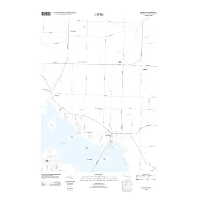
2013 Map of Linesville
USGS Topo · Published 2013About this map
Linesville serves as the primary hub of this Crawford County landscape, where the street grid meets the expansive eastern shores of the Pymatuning Reservoir. The area is defined by the significant footprint of Pymatuning State Park, which encompasses numerous islands such as Harris Island, Ford Island, and the Glenn Islands. To the north, the terrain transitions into a patchwork of rural crossroads and small settlements like Steamburg, Conneaut Center, and Dantown. Local aviation is represented by Merrys Pymatuning Airport, while recreational life is centered around Camp Iroquois and the water. The map traces the winding paths of Linesville Creek and Fish Creek as they drain toward the reservoir, illustrating the hydrological connection between the agricultural uplands and the massive artificial lake. Significant local thoroughfares, including Us-6 and Harmonsburg Road, connect these dispersed communities.
Find a feature on this map
68 named features on this map. Tap any name to fly to it.
Don’t see what you’re looking for? This feature index may not catch every label — zoom into the map to look around manually.
Map Details
Editions of this 2013 Linesville Map
This is the sole edition of this map. No revisions or reprints were ever made.
Other maps of this area

1900 · Girard
USGS Topo · 1:62,500

1905 · Andover
USGS Topo · 1:48,000

1906 · Conneaut
USGS Topo · 1:62,500

1906 · Linesville
USGS Topo · 1:62,500

1907 · Andover
USGS Topo · 1:62,500

1908 · Linesville
USGS Topo · 1:62,500

1950 · Cleveland
USGS Topo · 1:250,000

1956 · Cleveland
USGS Topo · 1:250,000

1959 · Conneautville
USGS Topo · 1:24,000

1959 · Hartstown
USGS Topo · 1:24,000
Featured Places
- Linesville, PA
- North Shenango Township, PA
- Summerhill Township, PA
- Tuttle Lake, Pymatuning Central
- Conneaut Center, PA