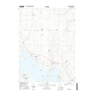
2016 Map of Linesville
USGS Topo · Published 2016About this map
The Pymatuning Reservoir dominates this landscape in western Crawford County, bordering the borough of Linesville. This contemporary topographic study reveals the intricate shoreline and several islands, including Harris Island, Whaley Island, and the Glenn Islands. The area exhibits a mix of developed lakeside communities like Pymatuning North and Pymatuning Central alongside more traditional agricultural settlements such as Steamburg and Conneaut Center. Genealogy researchers will find several small burial sites preserved on this map, including Manning Cem, Baldwin Cem, and Shaw Cem. The local infrastructure is highlighted by Merrys Pymatuning Airport and a grid of secondary roads like Center Road and Conneautville Rd that connect these rural pockets. Waterways such as Linesville Cr and Fish Cr feed into the reservoir, illustrating the natural drainage patterns of the region.
Find a feature on this map
74 named features on this map. Tap any name to fly to it.
Don’t see what you’re looking for? This feature index may not catch every label — zoom into the map to look around manually.
Map Details
Editions of this 2016 Linesville Map
This is the sole edition of this map. No revisions or reprints were ever made.
Other maps of this area

1900 · Girard
USGS Topo · 1:62,500

1905 · Andover
USGS Topo · 1:48,000

1906 · Conneaut
USGS Topo · 1:62,500

1906 · Linesville
USGS Topo · 1:62,500

1907 · Andover
USGS Topo · 1:62,500

1908 · Linesville
USGS Topo · 1:62,500

1950 · Cleveland
USGS Topo · 1:250,000

1956 · Cleveland
USGS Topo · 1:250,000

1959 · Conneautville
USGS Topo · 1:24,000

1959 · Hartstown
USGS Topo · 1:24,000
Featured Places
- Linesville, PA
- North Shenango Township, PA
- Summerhill Township, PA
- Tuttle Lake, Pymatuning Central
- Conneaut Center, PA