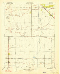
1948 Map of Lingard
USGS Topo · Published 1948About this map
Agricultural irrigation and drainage networks define this Central Valley landscape in the late 1940s, a period when the region was undergoing significant hydrological management. The map documents a complex system of sloughs and creeks, including Duck Slough and Mariposa Creek, interspersed with numerous windmills used for groundwater extraction. The Southern Pacific railroad line passes through the settlement of Lingard, which serves as a small rail hub near the northern boundary. Further south, the community of El Nido appears at the intersection of several local thoroughfares. This survey provides a precise record of rural infrastructure before mid-century expansion, capturing the locations of local educational landmarks such as Pioneer Sch, Russell Sch, and Bliss Sch. The grid of named roads like Sandy Mush Road and Healy Road outlines a landscape transitioning from natural drainage to structured water control via the Canal.
Find a feature on this map
25 named features on this map. Tap any name to fly to it.
Don’t see what you’re looking for? This feature index may not catch every label — zoom into the map to look around manually.
Map Details
Editions of this 1948 Lingard Map
This is the sole edition of this map. No revisions or reprints were ever made.
Other maps of this area

1914 · Merced
USGS Topo · 1:31,680

1916 · Santa Rita Bridge
USGS Topo · 1:24,000

1917 · Merced
USGS Topo · 1:31,680

1918 · Bliss Ranch
USGS Topo · 1:31,680

1918 · Lingard
USGS Topo · 1:31,680

1918 · Atwater
USGS Topo · 1:31,680

1918 · Chowchilla
USGS Topo · 1:31,680

1918 · Sandy Mush
USGS Topo · 1:31,680

1918 · Planada
USGS Topo · 1:31,680

1919 · Plainsberg
USGS Topo · 1:31,680