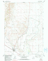
1963 Map of Lingle
USGS Topo · Published 1991About this map
Lingle serves as the focal point of this Goshen County landscape, where the agricultural infrastructure of the Missouri River Basin project is clearly visible. The complex irrigation network of the Interstate Canal and Lucerne Ditch defines the local economy, drawing water toward the fields surrounding the town. A historical layer of westward expansion is preserved through the route of the Emigrant Trail, which cuts across the southwestern corner of the quadrangle near the local Substation.
Find a feature on this map
19 named features on this map. Tap any name to fly to it.
Don’t see what you’re looking for? This feature index may not catch every label — zoom into the map to look around manually.
Map Details
Editions of this 1963 Lingle Map
3 editions found
Other maps of this area

1896 · Patrick
USGS Topo · 1:125,000

1954 · Torrington
USGS Topo · 1:250,000

1958 · Torrington
USGS Topo · 1:250,000

1960 · Habig Spring
USGS Topo · 1:24,000
1960 · Barnes
USGS Topo · 1:24,000
1960 · Cottier
USGS Topo · 1:24,000
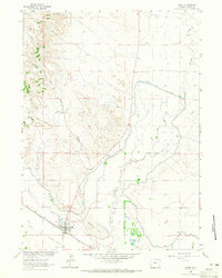
1963 · Lingle
USGS Topo · 1:24,000

1963 · Tea Kettle Rock
USGS Topo · 1:24,000
1963 · Torrington
USGS Topo · 1:24,000

1974 · Spoon Butte SW
USGS Topo · 1:24,000