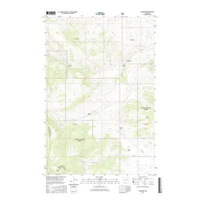
2017 Map of Lingshire
USGS Topo · Published 2017About this map
Lingshire sits at the intersection of remote Montana ranch lands and the rugged topography of the Helena National Forest. The landscape is defined by deep drainages and dramatic elevation changes, notably at Avalanche Butte and the Dry Range. Water sources are critical in this high country, marked by features such as Crystal Spring, Ashford Spring, and the various branches of Rock Creek. The naming conventions throughout the quadrangle reflect a colorful frontier heritage, with labels like Moonshine Gulch, Calamity Gulch, and Buffalo Canyon hinting at the historical uses and challenges of the terrain. Early transportation routes are represented by Lingshire Rd and Wagner Rd, which connect the scattered homesteads and grazing lands. This survey provides a clear view of the complex jurisdictional boundaries where Meagher, Broadwater, and Lewis and Clark Counties meet in the wilderness.
Find a feature on this map
26 named features on this map. Tap any name to fly to it.
Don’t see what you’re looking for? This feature index may not catch every label — zoom into the map to look around manually.
Map Details
Editions of this 2017 Lingshire Map
This is the sole edition of this map. No revisions or reprints were ever made.
Other maps of this area

1886 · Fort Logan
USGS Topo · 1:250,000

1948 · White Sulphur Springs
USGS Topo · 1:250,000

1950 · Canyon Ferry
USGS Topo · 1:62,500

1958 · White Sulphur Springs
USGS Topo · 1:250,000

1961 · White Sulphur Springs
USGS Topo · 1:250,000

1962 · B K Ranch
USGS Topo · 1:24,000

1962 · Snedaker Basin
USGS Topo · 1:24,000

1965 · White Sulphur Springs
USGS Topo · 1:250,000

1966 · Lingshire
USGS Topo · 1:24,000

1966 · Whites City
USGS Topo · 1:24,000