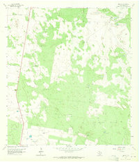
1963 Map of Linn NE
USGS Topo · Published 1965About this map
The livestock and ranching landscape of Hidalgo County is defined by a network of named pastures and essential water sources in this 1963 survey. Broad expanses such as Santa Fe Pasture, Padrones Pasture, and La Copita Pasture dominate the terrain, separated by a lattice of fence lines and private roads. The survival of these lands relies on scattered infrastructure, from the Maria Chavez Windmill and San Pedro Windmill to the Los Machos Well (Flowing) in the southeast.
Find a feature on this map
27 named features on this map. Tap any name to fly to it.
Don’t see what you’re looking for? This feature index may not catch every label — zoom into the map to look around manually.
Map Details
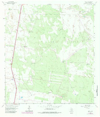
Editions of this 1963 Linn NE Map
2 editions found
Other maps of this area

1922 · La Sal Vieja
USGS Topo · 1:62,500

1923 · Armstrong
USGS Topo · 1:62,500

1939 · Linn
USGS Topo · 1:62,500

1949 · Mc Allen
USGS Topo · 1:250,000

1953 · Brownsville
USGS Topo · 1:250,000

1954 · McAllen
USGS Topo · 1:250,000

1956 · Julian
USGS Topo · 1:24,000

1956 · Andrea Ranch
USGS Topo · 1:24,000

1956 · La Sal Vieja
USGS Topo · 1:24,000

1956 · La Sal Vieja
USGS Topo · 1:62,500