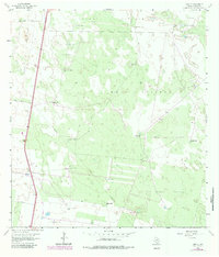
1963 Map of Linn NE
USGS Topo · Published 1983About this map
Large-scale ranching operations define this coastal plain landscape in Hidalgo County during the early 1960s. The map reveals an intricate system of water management essential for livestock, featuring a dense network of family-named and descriptive water sources such as the Maria Chavez Windmill, Esteban Windmill, and San Carlos Windmill. These features, along with several flowing wells like the Mula Well, highlight the reliance on groundwater for the various vast enclosures including Santa Fe Pasture and Los Machos Pasture.
Find a feature on this map
26 named features on this map. Tap any name to fly to it.
Don’t see what you’re looking for? This feature index may not catch every label — zoom into the map to look around manually.
Map Details
Editions of this 1963 Linn NE Map
2 editions found
Other maps of this area

1922 · La Sal Vieja
USGS Topo · 1:62,500

1923 · Armstrong
USGS Topo · 1:62,500

1939 · Linn
USGS Topo · 1:62,500

1949 · Mc Allen
USGS Topo · 1:250,000

1953 · Brownsville
USGS Topo · 1:250,000

1954 · McAllen
USGS Topo · 1:250,000

1956 · Julian
USGS Topo · 1:24,000

1956 · Andrea Ranch
USGS Topo · 1:24,000

1956 · La Sal Vieja
USGS Topo · 1:24,000

1956 · La Sal Vieja
USGS Topo · 1:62,500