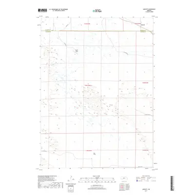
2017 Map of Linscott
USGS Topo · Published 2017About this map
Linscott sits at the northern edge of this high plains landscape, straddling the boundary where Blaine and Custer counties meet. The area is defined by its rural isolation and ranching infrastructure, most notably the Mc Ginn Ranch Airport located in the northwest. The terrain transitions into the distinct topography of Sand Valley to the south, a region marked by rolling depressions and sparse water features. A network of county and ranch roads, such as Hoosier Valley Rd and Rifle Creek Rd, provide the only modern corridors through this section of the Nebraska Sandhills. The map illustrates a landscape of large-scale land management, with section lines and township boundaries like t20n r24w organizing the vast, open spaces between scattered homesteads and drainages.
Find a feature on this map
19 named features on this map. Tap any name to fly to it.
Don’t see what you’re looking for? This feature index may not catch every label — zoom into the map to look around manually.
Map Details
Editions of this 2017 Linscott Map
This is the sole edition of this map. No revisions or reprints were ever made.
Other maps of this area

1948 · Linscott
USGS Topo · 1:62,500

1950 · Linscott
USGS Topo · 1:62,500

1951 · Dunning
USGS Topo · 1:62,500

1951 · Anselmo SW
USGS Topo · 1:24,000

1951 · Anselmo NW
USGS Topo · 1:24,000

1952 · Brewster SW
USGS Topo · 1:24,000

1954 · North Platte
USGS Topo · 1:250,000

1955 · Broken Bow
USGS Topo · 1:250,000

1956 · Broken Bow
USGS Topo · 1:250,000

1956 · North Platte
USGS Topo · 1:250,000