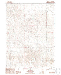
1986 Map of Linscott SE
USGS Topo · Published 1987About this map
Sand Valley dominates the northern half of this mid-1980s landscape, illustrating the distinctive topography of Custer County. The map provides a detailed view of the terrain through the lens of a provisional survey based on 1983 aerial photography. Evidence of land use and water management is visible through the presence of a Well and the drainage pattern of Dry Creek to the south. This area, spanning the township lines of T 19 N and T 18 N, represents a quiet agricultural or ranching environment before the arrival of modern digital mapping. The labels and contours reflect the essential infrastructure and natural features relied upon by local residents and land managers in the late twentieth century.
Find a feature on this map
6 named features on this map. Tap any name to fly to it.
Don’t see what you’re looking for? This feature index may not catch every label — zoom into the map to look around manually.
Map Details
Editions of this 1986 Linscott SE Map
This is the sole edition of this map. No revisions or reprints were ever made.
Other maps of this area

1948 · Linscott
USGS Topo · 1:62,500

1950 · Linscott
USGS Topo · 1:62,500

1951 · Callaway NW
USGS Topo · 1:24,000

1951 · Anselmo SW
USGS Topo · 1:24,000

1951 · Anselmo NW
USGS Topo · 1:24,000

1954 · North Platte
USGS Topo · 1:250,000

1955 · Broken Bow
USGS Topo · 1:250,000

1956 · Broken Bow
USGS Topo · 1:250,000

1956 · North Platte
USGS Topo · 1:250,000

1957 · North Platte
USGS Topo · 1:250,000