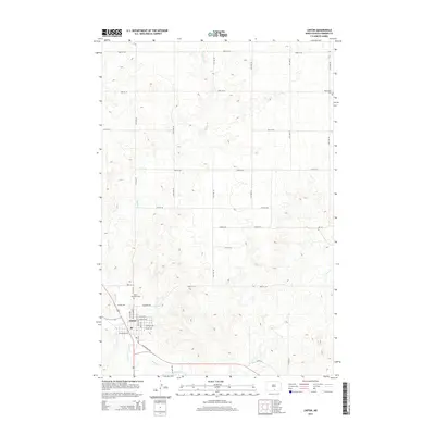
2014 Map of Linton
USGS Topo · Published 2014About this map
Linton stands at the confluence of agricultural and hydrologic history in Emmons County, where the southern reaches of the township meet the winding path of Beaver Cr. This 2014 survey captures the precise layout of the town’s residential grid, featuring streets like S Milwaukee Ave and W Sampson Ave that reflect the community's development over decades. The landscape beyond the town center is defined by a series of drainages, including Spring Cr and Clear Cr, which carve through the high plains of the Missouri Plateau. Genealogical researchers will find significant value in the documentation of local burial grounds, specifically Saint Anthonys Cem on the town's northern edge and the remote Bethlehem Cem situated in the northeastern quadrant of the sheet. The map also identifies the central Po, serving as a waypoint for the region's rural postal network.
Find a feature on this map
38 named features on this map. Tap any name to fly to it.
Don’t see what you’re looking for? This feature index may not catch every label — zoom into the map to look around manually.
Map Details
Editions of this 2014 Linton Map
This is the sole edition of this map. No revisions or reprints were ever made.
Other maps of this area

1954 · Bismarck
USGS Topo · 1:250,000

1958 · Bismarck
USGS Topo · 1:250,000

1971 · Hazelton
USGS Topo · 1:24,000

1971 · Grassna NE
USGS Topo · 1:24,000

1971 · Strasburg
USGS Topo · 1:24,000

1971 · Temvik
USGS Topo · 1:24,000

1975 · Appert Lake
USGS Topo · 1:24,000

1975 · Linton NE
USGS Topo · 1:24,000

1979 · Senger Lake North
USGS Topo · 1:24,000
1980 · Linton
USGS Topo · 1:24,000