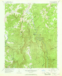
1956 Map of Linville Falls
USGS Topo · Published 1968About this map
Linville River carves a deep path through this mid-century survey of the Blue Ridge mountains, where the Pisgah National Forest meets the steep terrain of the Linville Gorge. The settlement at Linville Falls and nearby Altamont serve as anchor points in a landscape defined by sharp elevation changes and numerous ridges like Rogers Ridge and Jonas Ridge. Local history is preserved in the placement of small community centers such as Walnut Grove Ch and Concord Ch, while the Blue Ridge Parkway winds along the higher contours. The presence of Linville Caverns and the Tablerock Tower indicates early recreational development in this corner of the state, which is also crisscrossed by the headwaters of the North Fork Catawba River and Toe River.
Find a feature on this map
73 named features on this map. Tap any name to fly to it.
Don’t see what you’re looking for? This feature index may not catch every label — zoom into the map to look around manually.
Map Details
Editions of this 1956 Linville Falls Map
4 editions found
Other maps of this area

1891 · Roan Mountain
USGS Topo · 1:125,000

1893 · Cranberry
USGS Topo · 1:125,000

1894 · Roan Mountain
USGS Topo · 1:125,000

1895 · Cranberry
USGS Topo · 1:125,000

1899 · Cranberry
USGS Topo · 1:125,000

1900 · Mount Mitchell
USGS Topo · 1:125,000

1902 · Cranberry
USGS Topo · 1:125,000

1902 · Mount Mitchell
USGS Topo · 1:125,000

1904 · Roan Mountain
USGS Topo · 1:125,000

1905 · Morganton
USGS Topo · 1:125,000