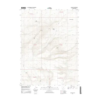
2015 Map of Lion Bluffs
USGS Topo · Published 2015About this map
Sweeney Ranch sits in the northeast corner of this high-altitude landscape, where the high desert terrain of the South Baxter Basin meets the rising slopes of the Uinta foothills. The map reveals a complex system of drainages including Snow Spring Cr, Blair Cr, and Burnt Canyon Cr, which carve through the land beneath prominent landmarks like Lion Bluffs and Chimney Rock.
Find a feature on this map
28 named features on this map. Tap any name to fly to it.
Don’t see what you’re looking for? This feature index may not catch every label — zoom into the map to look around manually.
Map Details
Editions of this 2015 Lion Bluffs Map
This is the sole edition of this map. No revisions or reprints were ever made.
Other maps of this area

1908 · Rock Springs
USGS Topo · 1:62,500

1910 · Rock Springs
USGS Topo · 1:62,500

1954 · Rock Springs
USGS Topo · 1:250,000

1958 · Rock Springs
USGS Topo · 1:250,000

1962 · Rock Springs
USGS Topo · 1:250,000

1968 · Point Of Rocks SW
USGS Topo · 1:24,000

1968 · Mud Springs Ranch
USGS Topo · 1:24,000
1968 · South Baxter
USGS Topo · 1:24,000
1968 · Earnest Butte
USGS Topo · 1:24,000
1968 · Rock Springs
USGS Topo · 1:24,000