
1968 Map of Point Of Rocks SW
USGS Topo · Published 1971About this map
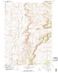
Salt Wells Creek and Black Butte Creek define the drainage patterns of this high desert terrain in the late 1960s. The landscape reflects a shift toward industrial utility, marked by scattered Drill Holes and a Gas Well that indicate subsurface exploration during this era. The topographic relief is dominated by the prominent Black Butte, which serves as a significant landmark in the eastern portion of the quadrangle. Evidence of infrastructure for communication and resource extraction is visible through the presence of a Radio Facility and a Gravel Pit. These features, documented through 1967 aerial photography, highlight the region's sparse settlement and its primary use for energy development and technical operations within the Sweetwater County corridor.
Find a feature on this map
7 named features on this map. Tap any name to fly to it.
Don’t see what you’re looking for? This feature index may not catch every label — zoom into the map to look around manually.
Map Details
Editions of this 1968 Point Of Rocks SW Map
2 editions found
Other maps of this area

1908 · Rock Springs
USGS Topo · 1:62,500

1910 · Rock Springs
USGS Topo · 1:62,500

1954 · Rock Springs
USGS Topo · 1:250,000

1958 · Rock Springs
USGS Topo · 1:250,000

1962 · Rock Springs
USGS Topo · 1:250,000

1968 · North Baxter
USGS Topo · 1:24,000

1968 · Cooper Ridge NE
USGS Topo · 1:24,000

1968 · Point Of Rocks
USGS Topo · 1:24,000

1968 · Camel Rock
USGS Topo · 1:24,000
1968 · Lion Bluffs
USGS Topo · 1:24,000