
1968 Map of Point Of Rocks
USGS Topo · Published 1972About this map
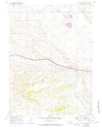
The Point of Rocks Stagecoach Station serves as a focal point in this high-desert corridor of Sweetwater County, where historical transportation routes converge. The map documents the enduring paths of the Overland Trail and the Point of Rocks South Pass Stage Route, which follow the natural contours alongside Bitter Creek. This intersection of eras is further underscored by the presence of the Union Pacific railroad and a modern Pipeline, illustrating the area's continued importance as a transit gateway across the Wyoming basin.
Find a feature on this map
15 named features on this map. Tap any name to fly to it.
Don’t see what you’re looking for? This feature index may not catch every label — zoom into the map to look around manually.
Map Details
Editions of this 1968 Point Of Rocks Map
2 editions found
Other maps of this area

1954 · Rock Springs
USGS Topo · 1:250,000

1958 · Rock Springs
USGS Topo · 1:250,000

1958 · Twelvemile Well
USGS Topo · 1:62,500

1958 · Superior
USGS Topo · 1:62,500

1962 · Rock Springs
USGS Topo · 1:250,000

1968 · Bitter Creek NW
USGS Topo · 1:24,000

1968 · Point Of Rocks SW
USGS Topo · 1:24,000

1968 · Black Buttes
USGS Topo · 1:24,000
1968 · Point Of Rocks SE
USGS Topo · 1:24,000
1968 · Thayer Junction
USGS Topo · 1:24,000