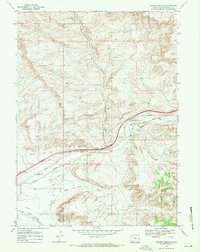
1968 Map of Thayer Junction
USGS Topo · Published 1972About this map
Union Pacific rail lines and the historical passage of the Overland Trail dominate this high-desert corridor of Sweetwater County. The map documents the industrial and transit landscape of the late 1960s, centered on the Thayer Junction and the northern settlement of Superior. Evidence of the region’s coal mining and energy heritage is visible through scattered prospects, a Gas Well, and an old railroad grade that snakes through Horsethief Canyon.
Find a feature on this map
17 named features on this map. Tap any name to fly to it.
Don’t see what you’re looking for? This feature index may not catch every label — zoom into the map to look around manually.
Map Details
Editions of this 1968 Thayer Junction Map
2 editions found
Other maps of this area

1908 · Rock Springs
USGS Topo · 1:62,500

1910 · Rock Springs
USGS Topo · 1:62,500

1954 · Rock Springs
USGS Topo · 1:250,000

1958 · Rock Springs
USGS Topo · 1:250,000

1958 · Boars Tusk
USGS Topo · 1:62,500

1958 · Superior
USGS Topo · 1:62,500

1962 · Rock Springs
USGS Topo · 1:250,000

1968 · North Baxter
USGS Topo · 1:24,000

1968 · Point Of Rocks SW
USGS Topo · 1:24,000

1968 · Point Of Rocks
USGS Topo · 1:24,000