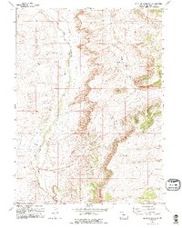
1968 Map of Point Of Rocks SW
USGS Topo · Published 1995About this map
Salt Wells Creek and Black Butte Creek define the drainage patterns of this high desert landscape in Sweetwater County. The terrain is dominated by the massive profile of Black Butte, which anchors the eastern portion of the quadrangle. This 1960s landscape shows the early footprints of industrial development, with infrastructure ranging from a Radio Facility to a Gas Well and several drill holes scattered across the plateaus. The topography is characterized by steep escarpments and dry washes, where resource extraction is evidenced by a Gravel Pit. The map captures a moment when traditional land use in Wyoming's basins was being joined by modern energy and communication networks.
Find a feature on this map
7 named features on this map. Tap any name to fly to it.
Don’t see what you’re looking for? This feature index may not catch every label — zoom into the map to look around manually.
Map Details
Editions of this 1968 Point Of Rocks SW Map
2 editions found
Other maps of this area

1908 · Rock Springs
USGS Topo · 1:62,500

1910 · Rock Springs
USGS Topo · 1:62,500

1954 · Rock Springs
USGS Topo · 1:250,000

1958 · Rock Springs
USGS Topo · 1:250,000

1962 · Rock Springs
USGS Topo · 1:250,000

1968 · North Baxter
USGS Topo · 1:24,000

1968 · Cooper Ridge NE
USGS Topo · 1:24,000

1968 · Point Of Rocks SW
USGS Topo · 1:24,000

1968 · Point Of Rocks
USGS Topo · 1:24,000

1968 · Camel Rock
USGS Topo · 1:24,000