
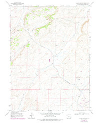
1968 Map of Cooper Ridge NE
USGS Topo · Published 1971About this map
Cooper Ridge dominates this high-desert portion of Sweetwater County, where the arid landscape is defined by an intricate network of drainage channels and mineral exploration. The terrain is deeply incised by Pinnacle Draw, Williams Draw, and Big Flat Draw, all of which eventually feed into the central course of Black Butte Creek. This 1968 field survey captures the area during a period of active resource scouting, indicated by various Prospect locations and scattered Drill Hole sites.
Find a feature on this map
12 named features on this map. Tap any name to fly to it.
Don’t see what you’re looking for? This feature index may not catch every label — zoom into the map to look around manually.
Map Details
Editions of this 1968 Cooper Ridge NE Map
2 editions found
Other maps of this area

1954 · Rock Springs
USGS Topo · 1:250,000

1958 · Rock Springs
USGS Topo · 1:250,000

1962 · Rock Springs
USGS Topo · 1:250,000

1968 · Point Of Rocks SW
USGS Topo · 1:24,000

1968 · Sand Butte Rim NW
USGS Topo · 1:24,000

1968 · Mud Springs Ranch
USGS Topo · 1:24,000

1968 · Black Buttes
USGS Topo · 1:24,000

1968 · Pine Butte
USGS Topo · 1:24,000

1968 · Camel Rock
USGS Topo · 1:24,000
1968 · Burley Draw
USGS Topo · 1:24,000