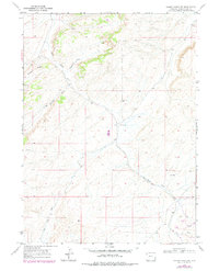
1968 Map of Cooper Ridge NE
USGS Topo · Published 1978About this map
Cooper Ridge defines the high ground in this arid corner of Sweetwater County, overlooking a complex system of drainage channels including Pinnacle Draw and Williams Draw. The landscape shows clear signs of mid-century resource exploration, with several labeled Prospects and a Gas Well located near Sand Wash in the southeastern portion of the quadrangle. These features indicate the region's transition into an energy-producing landscape during the late 1960s and 1970s. The winding course of Black Butte Creek cuts through the center of the sheet, providing the primary geographic orientation for the area. Surveyed originally in 1967 and updated with 1976 aerial photography, the map documents the sparse but industrially significant infrastructure of the High Desert before more modern expansions.
Find a feature on this map
14 named features on this map. Tap any name to fly to it.
Don’t see what you’re looking for? This feature index may not catch every label — zoom into the map to look around manually.
Map Details
Editions of this 1968 Cooper Ridge NE Map
2 editions found
Other maps of this area

1954 · Rock Springs
USGS Topo · 1:250,000

1958 · Rock Springs
USGS Topo · 1:250,000

1962 · Rock Springs
USGS Topo · 1:250,000

1968 · Cooper Ridge NE
USGS Topo · 1:24,000

1968 · Point Of Rocks SW
USGS Topo · 1:24,000

1968 · Sand Butte Rim NW
USGS Topo · 1:24,000

1968 · Mud Springs Ranch
USGS Topo · 1:24,000

1968 · Black Buttes
USGS Topo · 1:24,000

1968 · Pine Butte
USGS Topo · 1:24,000

1968 · Camel Rock
USGS Topo · 1:24,000