
1968 Map of Pine Butte
USGS Topo · Published 1972About this map
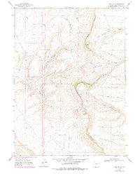
Kinney Rim and Sand Butte Rim define this arid landscape in Sweetwater County, where the high desert terrain is carved by a complex network of seasonal drainages. These prominent escarpments overlook a territory marked by early exploration and resource survey, indicated by scattered Drill Hole locations. Water sources are scarce but critical, centered on isolated points like Jackknife Spring and Sand Butte Spring. The drainage patterns, including Black Butte Creek and the winding Dripping Rock Draw, illustrate how water has shaped the high plains. This 1968 survey reveals a territory primarily used for open-range grazing and mineral exploration, where the vast scale of the terrain is broken only by these named waterholes and the sharp lines of the western rims.
Find a feature on this map
14 named features on this map. Tap any name to fly to it.
Don’t see what you’re looking for? This feature index may not catch every label — zoom into the map to look around manually.
Map Details
Editions of this 1968 Pine Butte Map
2 editions found
Other maps of this area

1954 · Rock Springs
USGS Topo · 1:250,000

1958 · Rock Springs
USGS Topo · 1:250,000

1962 · Rock Springs
USGS Topo · 1:250,000

1963 · Erickson-Kent Ranch
USGS Topo · 1:24,000

1968 · Cooper Ridge NE
USGS Topo · 1:24,000

1968 · Chicken Creek East
USGS Topo · 1:24,000

1968 · Sand Butte Rim NW
USGS Topo · 1:24,000

1968 · Sand Butte Rim SE
USGS Topo · 1:24,000
1968 · Burley Draw
USGS Topo · 1:24,000
1968 · Antelope Flats
USGS Topo · 1:24,000