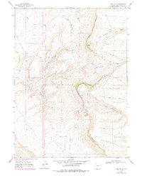
1968 Map of Pine Butte
USGS Topo · Published 1978About this map
Kinney Rim and Sand Butte Rim dominate this high-desert landscape in Sweetwater County, where complex drainage systems and isolated water sources defined the geography of the late 1960s and 1970s. The map illustrates a network of ephemeral washes and perennial points such as Jackknife Spring and Sand Butte Spring, which were vital markers for livestock and early travelers in this arid region. Significant erosional features like Dripping Rock Draw and Sand Butte Basin Creek reveal the intricate topography of the high plains, while the presence of scattered drill holes indicates subsurface exploration during this era. The map provides a detailed view of the natural hydrology, tracing the paths of Black Butte Creek and Alkali Creek as they carve through the sandstone formations.
Find a feature on this map
18 named features on this map. Tap any name to fly to it.
Don’t see what you’re looking for? This feature index may not catch every label — zoom into the map to look around manually.
Map Details
Editions of this 1968 Pine Butte Map
2 editions found
Other maps of this area

1954 · Rock Springs
USGS Topo · 1:250,000

1958 · Rock Springs
USGS Topo · 1:250,000

1962 · Rock Springs
USGS Topo · 1:250,000

1963 · Erickson-Kent Ranch
USGS Topo · 1:24,000

1968 · Cooper Ridge NE
USGS Topo · 1:24,000

1968 · Chicken Creek East
USGS Topo · 1:24,000

1968 · Sand Butte Rim NW
USGS Topo · 1:24,000

1968 · Pine Butte
USGS Topo · 1:24,000

1968 · Sand Butte Rim SE
USGS Topo · 1:24,000
1968 · Burley Draw
USGS Topo · 1:24,000