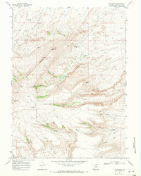
1968 Map of Lion Bluffs
USGS Topo · Published 1972About this map
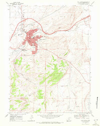
Quaking Asp Mountain dominates the western skyline of this survey, rising sharply above the plateau of south-central Wyoming. The landscape is defined by the high-elevation breaks of the Lion Bluffs and the distinctive formations of Chimney Rock and Table Mountain. In the late 1960s, this area of Sweetwater County was a focal point for resource extraction, evidenced by numerous Gas Wells, Drill Holes, and a Prospect scattered across the high ridges and deep drainages. Between the industrial footprints, the map captures a network of spring-fed waters such as Snow Spring Creek and Pine Spring, alongside public spaces like the Dotrence Recreation Park and Three Patches Picnic Area. The intricate contour work illustrates the complex drainages of Blair Canyon and Antelope Draw, revealing a terrain shaped by both geologic erosion and the energy demands of the mid-twentieth century.
Find a feature on this map
22 named features on this map. Tap any name to fly to it.
Don’t see what you’re looking for? This feature index may not catch every label — zoom into the map to look around manually.
Map Details
Editions of this 1968 Lion Bluffs Map
2 editions found
Other maps of this area

1908 · Rock Springs
USGS Topo · 1:62,500

1910 · Rock Springs
USGS Topo · 1:62,500

1954 · Rock Springs
USGS Topo · 1:250,000

1958 · Rock Springs
USGS Topo · 1:250,000

1962 · Rock Springs
USGS Topo · 1:250,000

1968 · Point Of Rocks SW
USGS Topo · 1:24,000

1968 · Mud Springs Ranch
USGS Topo · 1:24,000
1968 · South Baxter
USGS Topo · 1:24,000
1968 · Earnest Butte
USGS Topo · 1:24,000
1968 · Rock Springs
USGS Topo · 1:24,000