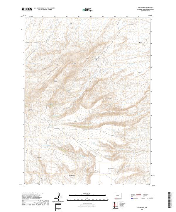
2021 Map of Lion Bluffs
USGS Topo · Published 2021About this map
High-altitude desert and prominent escarpments define this section of Sweetwater County, where the massive Lion Bluffs rise above the drainage of Sulphur Cr. The landscape is shaped by deep draws and intermittent streams, including No Name Cr and Burnt Canyon Cr, which flow toward the South Baxter Basin. Human presence is sparse and largely focused on ranching and public access, with Sweeney Ranch situated in the northeast and Dorrence Recreation Park offering a focal point for activity along Sweetwater Co Rd 39. Notable landmarks like Chimney Rock and the flat-topped Table provide essential navigation points across the uneven terrain, while Quaking Asp Mtn stands as a significant topographical feature to the west. This mapping shows a persistent pattern of rural land use, where remote corridors like Sweeney Ranch Rd connect isolated homesteads and grazing lands within the vast basins.
Find a feature on this map
28 named features on this map. Tap any name to fly to it.
Don’t see what you’re looking for? This feature index may not catch every label — zoom into the map to look around manually.
Map Details
Editions of this 2021 Lion Bluffs Map
This is the sole edition of this map. No revisions or reprints were ever made.
Other maps of this area

1908 · Rock Springs
USGS Topo · 1:62,500

1910 · Rock Springs
USGS Topo · 1:62,500

1954 · Rock Springs
USGS Topo · 1:250,000

1958 · Rock Springs
USGS Topo · 1:250,000

1962 · Rock Springs
USGS Topo · 1:250,000

1968 · Point Of Rocks SW
USGS Topo · 1:24,000

1968 · Mud Springs Ranch
USGS Topo · 1:24,000
1968 · South Baxter
USGS Topo · 1:24,000
1968 · Earnest Butte
USGS Topo · 1:24,000
1968 · Rock Springs
USGS Topo · 1:24,000