1994 Map of Lion Mountain
USGS Topo · Published 1996About this map
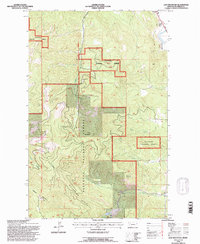
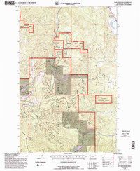
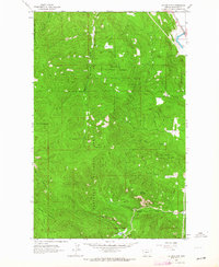
Lion Mountain and the Salish Mountains anchor this 1990s U.S. Forest Service revision of the Montana high country. The landscape is defined by the heavy timber of the Flathead National Forest, where a complex network of forest roads and trails provides access to high-elevation points like Baldy Mountain and Blacktail Mountain. A notable relic of earlier industrial infrastructure is the Old RR Grade winding along the northeastern edge of the sheet, tracing a path through the steep terrain above the drainage basins.
Find a feature on this map
20 named features on this map. Tap any name to fly to it.
Don’t see what you’re looking for? This feature index may not catch every label — zoom into the map to look around manually.
Map Details
Editions of this 1994 Lion Mountain Map
2 editions found
Other maps of this area

1920 · Flathead Lake
USGS Topo · 1:125,000

1943 · Kalispell
USGS Topo · 1:125,000

1956 · Wallace
USGS Topo · 1:250,000

1957 · Kalispell
USGS Topo · 1:250,000

1960 · Kalispell
USGS Topo · 1:250,000

1960 · Wallace
USGS Topo · 1:250,000

1961 · Kalispell
USGS Topo · 1:250,000
1962 · Kila
USGS Topo · 1:24,000
1962 · Blue Grass Ridge
USGS Topo · 1:24,000
1962 · Lion Mountain
USGS Topo · 1:24,000