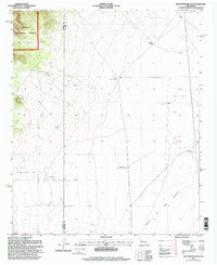
1995 Map of Lion Mountain NW
USGS Topo · Published 1998About this map
The Plains of San Agustin dominate the southeastern landscape of this region, meeting the high country along the border of Catron and Socorro counties. In the mid-1990s, this area functioned as a highly developed ranching environment within the Cibola National Forest. The map documents an extensive network of water infrastructure essential for livestock and remote living, including the Antelope Windmill, West Chavez Windmill, and East Chavez Windmill. Toward the west, the terrain rises sharply into forested ridges where more specialized features like No 3 Tank and the Fullerton Well are situated. A small Landing Area and several pits suggest the practical requirements of managing such a large, arid tract of public land. The presence of North Lake in the northeast corner provides a rare permanent water marker in an otherwise seasonally dry basin.
Find a feature on this map
13 named features on this map. Tap any name to fly to it.
Don’t see what you’re looking for? This feature index may not catch every label — zoom into the map to look around manually.
Map Details
Editions of this 1995 Lion Mountain NW Map
This is the sole edition of this map. No revisions or reprints were ever made.
Other maps of this area

1954 · Socorro
USGS Topo · 1:250,000

1958 · Socorro
USGS Topo · 1:250,000

1962 · Socorro
USGS Topo · 1:250,000

1963 · Cal Ship Mesa
USGS Topo · 1:24,000

1963 · Anderson Peak
USGS Topo · 1:24,000

1963 · Datil
USGS Topo · 1:24,000

1964 · Arrowhead Well
USGS Topo · 1:24,000

1964 · Indian Mesa
USGS Topo · 1:24,000

1964 · Dog Springs
USGS Topo · 1:24,000

1964 · Lion Mountain
USGS Topo · 1:24,000