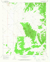
1965 Map of Lion Mountain
USGS Topo · Published 1967About this map
Cibola National Forest encompasses the rugged elevations of the Gallinas Mountains in this mid-1960s study of Socorro County. The landscape is defined by its arid cattle-country infrastructure, where survival and industry depend on scattered water sources like High Lonesome Well, Deep Well, and East Chavez Tank. The presence of the Double H Ranch and several family-named landmarks indicates a sparse but established ranching community utilizing the expansive terrain of Antelope Flats. Central to the sheet is the summit of Lion Mountain, which stands as a prominent topographical anchor overlooking the transition from high mountain forest to the alluvial plains below. The mapping detail highlights a network of unimproved roads and windmills, such as Three Section Windmill and East Windmill, which were essential for maintaining livestock across these remote New Mexico rangelands.
Find a feature on this map
15 named features on this map. Tap any name to fly to it.
Don’t see what you’re looking for? This feature index may not catch every label — zoom into the map to look around manually.
Map Details
Editions of this 1965 Lion Mountain Map
2 editions found
Other maps of this area

1954 · Socorro
USGS Topo · 1:250,000

1958 · Socorro
USGS Topo · 1:250,000

1962 · Socorro
USGS Topo · 1:250,000

1964 · Arrowhead Well
USGS Topo · 1:24,000

1964 · Indian Mesa
USGS Topo · 1:24,000

1964 · Tres Montosas
USGS Topo · 1:24,000

1964 · Dog Springs
USGS Topo · 1:24,000

1964 · Gallinas Peak
USGS Topo · 1:24,000

1964 · Lion Mountain
USGS Topo · 1:24,000
1964 · Indian Spring Canyon
USGS Topo · 1:24,000