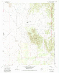
1965 Map of Lion Mountain
USGS Topo · Published 1986About this map
Cibola National Forest encompasses the rugged centerpiece of this Socorro County landscape, dominated by the peaks of the Gallinas Mountains and the prominent summit of Lion Mountain. This mid-century survey captures a ranching environment defined by its water infrastructure, where survival and industry depend on scattered improvements like High Lonesome Well, East Windmill, and Three Section Windmill. The terrain transitions from the high elevations down to Antelope Flats, illustrating the vast open spaces typical of central New Mexico.
Find a feature on this map
16 named features on this map. Tap any name to fly to it.
Don’t see what you’re looking for? This feature index may not catch every label — zoom into the map to look around manually.
Map Details
Editions of this 1965 Lion Mountain Map
2 editions found
Other maps of this area

1954 · Socorro
USGS Topo · 1:250,000

1958 · Socorro
USGS Topo · 1:250,000

1962 · Socorro
USGS Topo · 1:250,000

1964 · Arrowhead Well
USGS Topo · 1:24,000

1964 · Indian Mesa
USGS Topo · 1:24,000

1964 · Tres Montosas
USGS Topo · 1:24,000

1964 · Dog Springs
USGS Topo · 1:24,000

1964 · Gallinas Peak
USGS Topo · 1:24,000

1964 · Lion Mountain
USGS Topo · 1:24,000
1964 · Indian Spring Canyon
USGS Topo · 1:24,000