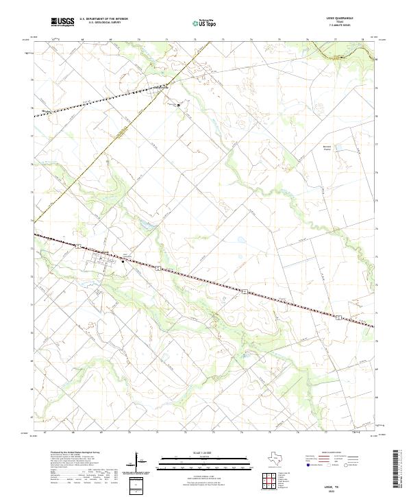
2022 Map of Lissie
USGS Topo · Published 2022About this map
The agricultural plains of Wharton County define this landscape, where the San Bernard River and its various tributaries form a intricate drainage system across the coastal prairie. The small settlement of Lissie serves as a central landmark, situated along Alt 90 and characterized by its organized street grid including Main St and Franklin St. Nearby, the Lissie Community Cem provides a focal point for local genealogical interest, documenting the families who settled this productive farming region.
Find a feature on this map
53 named features on this map. Tap any name to fly to it.
Don’t see what you’re looking for? This feature index may not catch every label — zoom into the map to look around manually.
Map Details
Editions of this 2022 Lissie Map
This is the sole edition of this map. No revisions or reprints were ever made.
Other maps of this area

1952 · Egypt
USGS Topo · 1:24,000

1953 · Hungerford
USGS Topo · 1:24,000

1953 · Seguin
USGS Topo · 1:250,000

1956 · Wallis
USGS Topo · 1:62,500

1957 · Eagle Lake
USGS Topo · 1:62,500

1958 · Seguin
USGS Topo · 1:250,000

1959 · Bonus
USGS Topo · 1:24,000

1960 · Lissie
USGS Topo · 1:24,000

1960 · Wallis
USGS Topo · 1:24,000
1960 · East Bernard
USGS Topo · 1:24,000