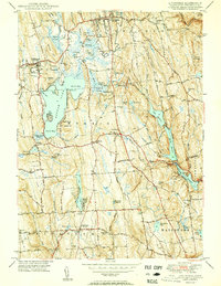
1950 Map of Litchfield
USGS Topo · Published 1950About this map
Bantam Lake dominates the central landscape of this Connecticut survey, its expansive waters framed by North Bay and South Bay. The shoreline and surrounding hills reveal a well-established network of residential and recreational activity at mid-century, including the specialized grounds of Camp Columbia and the small settlement at Lakeside. The area's agricultural and rural heritage is evident in the numerous small family-named heights such as Wheeler Hill and Schermerhorn Hill, while the village of Litchfield sits to the north near the Bantam River.
Find a feature on this map
58 named features on this map. Tap any name to fly to it.
Don’t see what you’re looking for? This feature index may not catch every label — zoom into the map to look around manually.
Map Details
Editions of this 1950 Litchfield Map
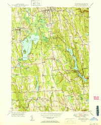
2 editions found
Other maps of this area

1892 · Winsted
USGS Topo · 1:62,500

1892 · Cornwall
USGS Topo · 1:62,500

1892 · New Milford
USGS Topo · 1:62,500

1893 · Waterbury
USGS Topo · 1:62,500

1893 · New Milford
USGS Topo · 1:62,500

1893 · Cornwall
USGS Topo · 1:62,500

1903 · Cornwall
USGS Topo · 1:62,500

1904 · New Milford
USGS Topo · 1:62,500

1904 · Waterbury
USGS Topo · 1:62,500

1904 · Litchfield
USGS Topo · 1:125,000