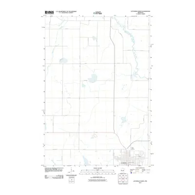
2010 Map of Litchfield North
USGS Topo · Published 2010About this map
Litchfield anchors the southern portion of this region, serving as a hub where the municipal grid meets the sprawling agricultural landscape of Meeker County. The city layout is detailed with specific landmarks such as the Meeker County Fairgrounds and the Litchfield Post Office, alongside the Calvary Cemetery on the eastern edge of town. This landscape is defined by its drainage patterns, most notably the winding course of the North Fork Crow River as it snakes through the eastern sections, complemented by the Middle Fork Crow River and Grove Creek to the northwest. The map captures the highly organized rural road system, including Csah 3 and County Hwy 11, which illustrate the modern transportation network supporting the area's farming economy at the start of the 21st century.
Find a feature on this map
33 named features on this map. Tap any name to fly to it.
Don’t see what you’re looking for? This feature index may not catch every label — zoom into the map to look around manually.
Map Details
Editions of this 2010 Litchfield North Map
This is the sole edition of this map. No revisions or reprints were ever made.
Other maps of this area

1953 · Saint Cloud
USGS Topo · 1:250,000

1957 · Saint Cloud
USGS Topo · 1:250,000

1958 · Saint Cloud
USGS Topo · 1:250,000

1958 · Dassel
USGS Topo · 1:62,500

1967 · Grove City
USGS Topo · 1:24,000

1967 · Litchfield South
USGS Topo · 1:24,000

1967 · Litchfield North
USGS Topo · 1:24,000

1967 · Lake Koronis
USGS Topo · 1:24,000
1967 · Rosendale
USGS Topo · 1:24,000

1967 · Watkins
USGS Topo · 1:24,000