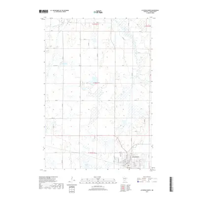
2019 Map of Litchfield North
USGS Topo · Published 2019About this map
Litchfield sits at the southern edge of this prairie landscape, serving as a focal point for the surrounding Meeker County agricultural region. The town's grid is well-defined by historical streets like W Depot St and E South St, while Calvary Cem lies just to the northeast. This 2019 survey documents a terrain defined by its water system, where the Middle Fork Crow River and North Fork Crow River snake through a patchwork of wetlands and small lakes including Towers Lake and Stone Lake. The map illustrates the persistence of the section-line road network, with routes like Co St Aid Hwy 16 and Co Rd 11 providing the primary structure for rural travel between scattered farmsteads and the glacial lakes.
Find a feature on this map
37 named features on this map. Tap any name to fly to it.
Don’t see what you’re looking for? This feature index may not catch every label — zoom into the map to look around manually.
Map Details
Editions of this 2019 Litchfield North Map
This is the sole edition of this map. No revisions or reprints were ever made.
Other maps of this area

1953 · Saint Cloud
USGS Topo · 1:250,000

1957 · Saint Cloud
USGS Topo · 1:250,000

1958 · Saint Cloud
USGS Topo · 1:250,000

1958 · Dassel
USGS Topo · 1:62,500

1967 · Grove City
USGS Topo · 1:24,000

1967 · Litchfield South
USGS Topo · 1:24,000

1967 · Litchfield North
USGS Topo · 1:24,000

1967 · Lake Koronis
USGS Topo · 1:24,000
1967 · Rosendale
USGS Topo · 1:24,000

1967 · Watkins
USGS Topo · 1:24,000