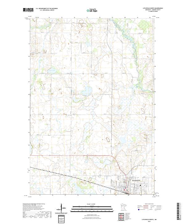
2022 Map of Litchfield North
USGS Topo · Published 2022About this map
Litchfield sits at the southern edge of this West Central Minnesota landscape, where the northern expansion of the town meets the complex wetland and river systems of Meeker County. The survey highlights the civic core of the community, anchored by the Meeker County Courthouse and nearby Calvary Cem. North of the settled area, the terrain is defined by a dense network of lakes and waterways, including Stone Lake and Towers Lake, alongside the winding courses of Middle Fork Crow River and North Fork Crow River. The drainage patterns of Jewett Cr and Grove Cr further illustrate the glaciated topography that shapes the agricultural plots and county road network. The map reveals a transition from organized town streets to the rhythmic section lines of the township and range system, providing a clear view of how land use and hydrology intersect in this prairie region.
Find a feature on this map
60 named features on this map. Tap any name to fly to it.
Don’t see what you’re looking for? This feature index may not catch every label — zoom into the map to look around manually.
Map Details
Editions of this 2022 Litchfield North Map
This is the sole edition of this map. No revisions or reprints were ever made.
Other maps of this area

1953 · Saint Cloud
USGS Topo · 1:250,000

1957 · Saint Cloud
USGS Topo · 1:250,000

1958 · Saint Cloud
USGS Topo · 1:250,000

1958 · Dassel
USGS Topo · 1:62,500

1967 · Grove City
USGS Topo · 1:24,000

1967 · Litchfield South
USGS Topo · 1:24,000

1967 · Litchfield North
USGS Topo · 1:24,000

1967 · Lake Koronis
USGS Topo · 1:24,000
1967 · Rosendale
USGS Topo · 1:24,000

1967 · Watkins
USGS Topo · 1:24,000