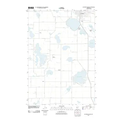
2010 Map of Litchfield South
USGS Topo · Published 2010About this map
Litchfield anchors the northern edge of this 2010 survey, which illustrates the transition from the city's residential streets to the agricultural and lake-dotted landscape of southern Meeker County. The region is defined by a dense concentration of glacial basins, ranging from the recreational waters of Lake Ripley and Lake Minnie-Belle to smaller features like Thoen Lake and Mud Lake. These water bodies dictated the placement of early settlements and social centers, such as Strout and Beckville, as well as local aviation sites like the L and M Aerodrome and the Litchfield Municipal Airport. For genealogists, the map preserves the locations of Ness Cemetery and Ripley Cemetery, situated near the shoreline of East Lake Ripley. The grid of county highways and gravel roads, including Csah 1 and County Hwy-23, connects these rural communities, maintaining a layout that has changed little since the early settlement era.
Find a feature on this map
50 named features on this map. Tap any name to fly to it.
Don’t see what you’re looking for? This feature index may not catch every label — zoom into the map to look around manually.
Map Details
Editions of this 2010 Litchfield South Map
This is the sole edition of this map. No revisions or reprints were ever made.
Other maps of this area

1953 · New Ulm
USGS Topo · 1:250,000

1953 · Saint Cloud
USGS Topo · 1:250,000

1957 · Saint Cloud
USGS Topo · 1:250,000

1957 · New Ulm
USGS Topo · 1:250,000

1958 · New Ulm
USGS Topo · 1:250,000

1958 · Saint Cloud
USGS Topo · 1:250,000

1958 · Dassel
USGS Topo · 1:62,500

1958 · Hutchinson
USGS Topo · 1:62,500

1967 · New Ulm
USGS Topo · 1:250,000

1967 · Grove City
USGS Topo · 1:24,000